Before dawn on a chilly morning in late January, Cal State Fullerton geography undergraduate students Justin Leist-Alston and Miranda Esteves joined Zia Salim, professor of geography and the environment, to collect data on Orange County’s homeless population.
Throughout the day, Salim and his students traveled south along the Santa Ana River, talking with people, providing snack kits, and recording information and surveys in an app.
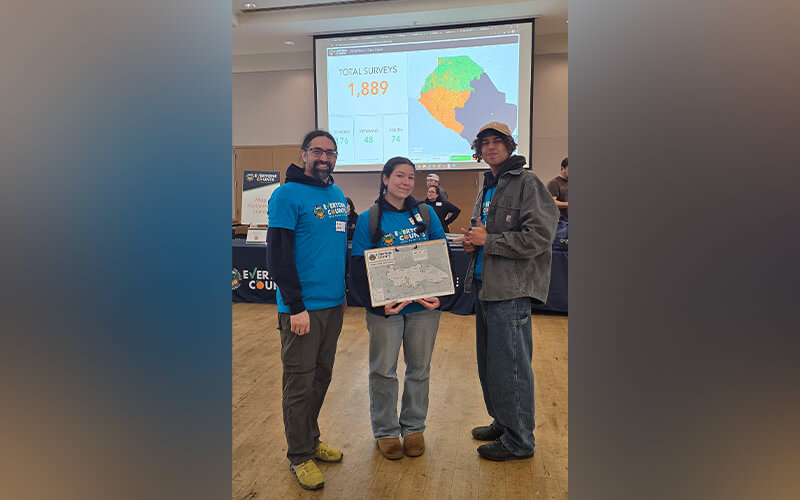
These three Titan geographers were among 1,200 trained volunteers who walked or drove across the county from Jan. 27-29, as part of a systematic effort to tally and survey people sleeping in places that are not designed to be regular sleeping accommodations. The point-in-time homelessness count, a federally mandated observational survey that takes place nationwide, aims to provide a snapshot of the scope of homelessness in a particular area. Orange County submits results to the U.S. Department of Housing and Urban Development, and the data and results help inform local efforts to address homelessness and guide the distribution of federal funding.
Leist-Alston, Esteves and Salim, along with UCLA geographer Frida Pacheco, county employee Julian Gutierrez, and two Orange County sheriff’s deputies, met at 4 a.m. at the Brea Community Center, one of two deployment centers for North Orange County. As part the county’s biennial point-in-time homeless count, their team was assigned to several areas in northeastern Orange County, where data indicated higher concentrations of individuals experiencing homelessness, as well as areas where law enforcement assistance would be required.
Leist-Alston, who participated in the count for the first time, reflected on his experience: “Oftentimes people experiencing homeless are dehumanized, disregarded and seen as dangerous. Having the opportunity to challenge those stereotypes and support their communities was a great privilege.”
“Everyone we talked with was super down to Earth and open to talk with us,” added Esteves, who also participated in the count for the first time.
Given the spatial aspects of this complex effort, it is unsurprising that geography underlies the count’s planning and execution in several ways. The app that more than a thousand volunteers used was developed on a platform created by ESRI, one of the leading Geographic Information Systems firms. Each team was provided with paper maps to plan their canvassing and navigation. These carefully designed paper maps, based on input from multiple stakeholders, indicated areas of interest, places where law enforcement support would be needed, canvassing area boundaries and more. Results from the volunteer teams were displayed in real time on maps in the deployment center.
Salim, a professor in the Department of Geography and the Environment who also teaches courses as part of CSUF’s new interdisciplinary urban studies minor, noted that geography students have been involved in several point-in-time counts over the past 10 years.
“We are proud of what our students accomplished this year. They knew that volunteering for this important community effort meant that they would have to wake up at 3 a.m. on a cold morning, but they also knew that their efforts would help make a difference for our neighbors who experience homelessness in Orange County. As geography faculty, we want our students to have first-hand experience understanding real-world problems, and we also value opportunities where we can contribute side-by-side with them,” said Salim.