The catastrophic flood devastation in Texas left in the wake of Hurricane Harvey is a reminder it could happen in Southern California — especially in low-lying areas near the region’s water sources.
“Floods are a serious threat to our region,” said Cal State Fullerton’s Matthew E. Kirby, professor of geological sciences. “Land-falling hurricanes are highly unlikely in Southern California, but they are not out of the realm of possibility.”
CSUF geologist Joe Carlin, a native of Dallas, Texas, agreed: “Perhaps the most important lesson we can learn is rather than being worried about it, we need to recognize this risk and be prepared.”
Flooding occurs when the amount of water exceeds the capacity of the drainage system, such as a basin, channel or river, the geological scientists explained.
The region’s greatest threat are large atmospheric rivers — a weather phenomenon that contains huge amounts of water vapor and usually brings heavy precipitation to the West Coast — associated with Pacific Ocean-sourced winter cyclones, Kirby added.
Southern California’s low-lying areas adjacent to river channels, creeks and flood-control basins, or downstream from dams, as well as coastal areas, are most vulnerable, noted Carlin, assistant professor of geological sciences.
Hunting for Clues About California’s Water History
While lessons will be learned from Hurricane Harvey, the CSUF researchers are studying California’s and the region’s water history, including floods and droughts. In 2015, Carlin investigated flood deposits in the Gulf of Mexico from the Brazos River, which flows west of Houston and is currently experiencing record flooding due to Hurricane Harvey.
“The flood deposits were not from a hurricane, but had set records for that river, which likely will be exceeded during these floods from Hurricane Harvey,” he said.
Carlin and his students are working on a research project in Upper Newport Bay to determine whether sedimentation in habitats, such as marshes and mudflats, is sufficient to keep pace with sea-level rise. A side result of the research shows evidence of massive flooding in Orange County nearly 50 years ago.
Kirby, who studies the history of precipitation in California, is investigating lake and wetland mud sediments. His National Science Foundation-funded research focuses on understanding the past 10,000 years of California’s water history — why and how water varies across the state.
Geology graduate student Jen Palermo is working on a Southern California flood history using sediments from Crystal Lake, located in the San Gabriel Mountains. Kirby and his students also have a journal paper in review documenting a large flood event in Lake Elsinore during the mid-Holocene period, about 4,800 years ago.
“It is highly likely that this flood is larger than anything we’ve seen in the historical record,” he said.
Most recently, with a nearly $550,000 joint grant from NSF to CSUF and UCLA, Kirby is collaborating with UCLA geography professor Glen MacDonald, Carlin and CSUF mathematics faculty members Kevin Nichols and Reza Ramezan on a three-year research project. The collaborative effort aims to reconstruct the history of floods, drought, fire and vegetation in California over the past 3,000 years.
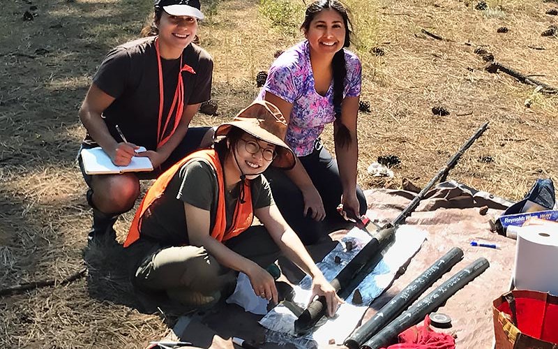
In August, the researchers, including Carlin and several geology students, conducted their first season of fieldwork for the project at Barley Lake, nearly 600 miles from campus in the Mendocino National Forest.
“In this latest study, we’ll look into whether large floods produced precipitation events more frequently during past wet climates,” Kirby continued. “How global climate change will change flood risk or probability in Southern California remains a debate.”