Wildfires across the globe pose a lethal threat to humans, wildlife, property and biodiversity. In California, where the frequency of fires has skyrocketed, these destructive blazes sparked a novel idea for a team of Cal State Fullerton mechanical engineering students.
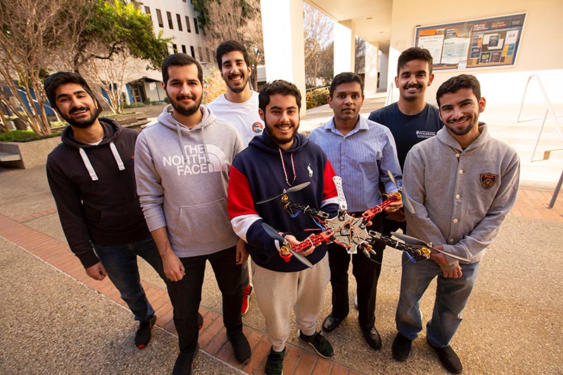
To help in the fight against wildfires and climate change, the students are developing a system called “Wildfire Aversion by Forecast and Early Response System,” or WAFERS. Their vision is to create a system using smart drone technology to predict and track the spread of wildfires, and ultimately, prevent fires from growing to an uncontrollable size, said student co-lead Abdulmohsen Aleissa.
These devastating infernos, such as the recent raging wildfires in Australia, deposit massive amounts of carbon dioxide into the atmosphere and contribute to global warming, Aleissa said. As a result, the rise in the average global temperature due to climate change causes future wildfires to increase in frequency and intensity.
The students’ solution is to utilize a smart drone and a sophisticated algorithm, which is capable of producing highly accurate estimations of wildfire spread that can be visualized over a specific surveyed area, Aleissa explained.
“The process takes significantly less time and effort than normal means of predicting wildfire spread, while still maintaining sufficient accuracy for the authorities to take action,” he added.
The team’s prototype, which uses a multidisciplinary approach involving areas such as thermodynamics, heat transfer, computer-aided engineering and data-driven technologies, is getting attention. The team won second place and a $2,000 prize in the Pix4D Climate Contest, where college and industry teams from 31 countries competed with projects that address the climate crisis.
Other members of the team are co-lead Abdulmohsen Albisher, Abdualwahab Alrashed, Abdallah Almodhyan, Abdullwhab Alsaleh and Rashed Alazemi.
“Our goal is to fully develop a fire simulation model that is capable of producing accurate results in a timely manner,” Aleissa said. “The algorithm that the team was able to create has shown results with very high accuracy. This could mean that in real-life scenarios, WAFERS could offer a faster, cheaper and more efficient approach to predict wildfire spread.”
The students’ project is an alternative approach to currently used wildfire spread simulation models. It uses an algorithm that computes the behavior of the fire without the large amounts of computer processing power that other fire simulation models use, said Sagil James, assistant professor of mechanical engineering, the team’s research adviser.
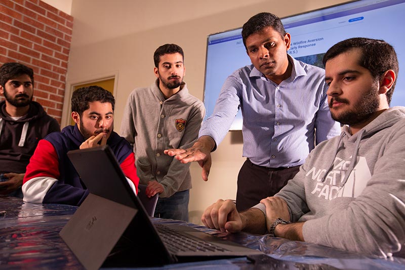
The project utilizes smart drone technology to construct an orthomosaic map — an aerial photograph of a fire that accurately depicts the picture without any distortion — through the use of Pix4D software, which is used for drone mapping. The software is analyzed by the WAFERS algorithm to predict and visually represent the projected wildfire spread perimeter, James said. The team is manufacturing the drone parts using 3D printers in the mechanical engineering lab on campus.
Tests of their prototype show that results can be obtained within a maximum of 10 minutes with the WAFERS algorithm — unlike other simulation models that can take upwards of two to three days to fully gather information and run the simulations, James said.
Additionally, other models require large amounts of data, such as lab analysis, satellite images and weather forecasts.
“The orthomosaic photo is used in lieu of satellite images and the algorithm automatically fetches all of the data and conducts the simulation,” Aleissa added.
The team members, all seniors and international students from Kuwait, plan to present their research at conferences this year and publish a journal paper in the fall.