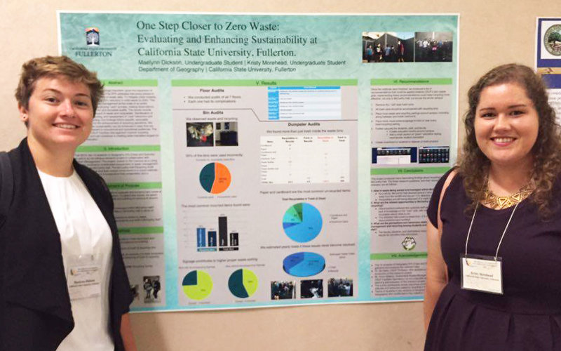
A sustainability poster created by Cal State Fullerton undergraduate geography students recently received the first place Joe Beaton Poster Award at the 2016 Conference of the California Geographical Society.
The poster, titled “One Step Closer to Zero Waste: Evaluating and Enhancing Sustainability at California State University, Fullerton,” summarized a semesterlong analysis of the waste and recycling of a university building – from the desktop bins to the dumpsters – to assess how recycling is working to divert items from landfills. The information was gathered by students in Cities and Suburbs, a spring course taught by Zia Salim, assistant professor of geography.
Maelynn Dickson ’16 (B.A. geography-environmental analysis) and Kristy Morehead ’16 (B.A. geography-environmental analysis) presented the poster at the 70th annual conference in San Jose, on behalf of the class of 14 students.
The mixed methods study addresses important urban sustainability questions and is an example of the Campus as a Living Lab – a model that gives students hands-on experience using the university environment to conduct research and analysis with peers, said Salim.
“In this case the students were examining McCarthy Hall, but assessing waste and recycling at the scale of an entire university building gives them a basis for thinking about the wider implications for the university and the city,” he said.
The project’s analysis will help University Facilities Management understand how to improve CSUF’s waste diversion rate. CSUF achieved a 58 percent diversion from landfills in 2015, one year after campuswide recycling programs began. The CSU goal is to reach 80 percent waste diversion by 2020.
In total, 36 posters were presented at the California Geographical Society conference by graduate and undergraduate students. Graduate student Elizabeth Higgins ’13 (B.A. geography) received a third-place award for her graduate-level poster on climate change in the Chukchi Sea, and Gregory Beringer ’16 (B.A. geography) took third place for his cartography project, mapping wartime operations of the USS Sevier from 1943-45.