A weekend adventure awaits for 20 students during the last weekend of March. Stratis Karantanellis, assistant professor of geological sciences, is leading a course called 3D Close Range Sensing of Arid Environments at the CSU Desert Studies Center.
Located in Zzyzx, the heart of the Mojave Desert, the DSC hosts unique programming based on the region’s diverse landscape. Its newest course involves three days in the field collecting, processing and interpreting spatial data while exploring desert geomorphology, environmental change and natural hazards.
“The Mojave Desert offers a spectacular natural laboratory where geomorphic features, environmental processes and natural hazards are exposed and easily observed,” said Karantanellis, whose research ranges across landslides, engineering geology, geohazards, remote sensing, Geographic Information Systems, slope stability and disaster risk management.
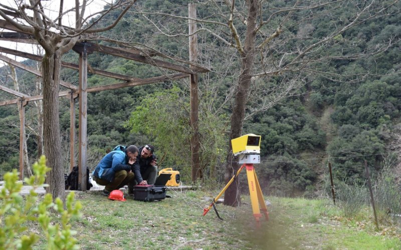
Students will take their own measurements, fly drones and operate LiDAR equipment, seeing how these tools impact their understanding of landscape evolution and environmental change.
“For me, it’s all about bridging the gap between classroom concepts and real-world challenges, and there’s no better place to do that than the Mojave Desert,” said Karantanellis.
He describes this course as “truly one-of-a-kind” because it combines learning with adventure. It’s about gaining new skills, putting together a portfolio and implementing learned methods toward future research or jobs.
“I love being part of that journey, guiding participants as they connect theory to practice and push the boundaries of what they thought they could do,” said Karantanellis. “Those moments of curiosity and collaboration are what keep me coming back, year after year.”
Furthermore, one-on-one mentorship and team collaboration elevate the learning experience. Skills like organization and adaptability go hand in hand with collaboration, as students will work together on a data collection.
“Fieldwork is rarely a solo adventure. Tackling real-world challenges with a team brings out the best in everyone.”
Karantanellis recommends this course to those interested in or working on understanding, measuring or managing the environment. The tools set up will be directly relevant to challenges that engineers, geoscientists, GIS specialists, ecologists and archaeologists might face in their careers.
“Students and professionals walk away not only with new technical skills and confidence, but also with connections to peers who share a passion for geoscience — and maybe even a few good stories from the desert.”
Visit the University Extension website to sign up for the course from March 27-29. View Karantanellis’ video interview on YouTube.